


About Islandeering
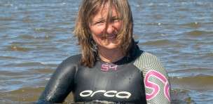
Hi and welcome to Islandeering Islandeering is for people who want adventure in Britain’s wild blue spaces – our rivers, coast, lakes, canals and islands. You will find amazing walks, paddles and swims in the UK’s most special places, those recognised for outstanding natural beauty, incredible geology or special and abundant wildlife.
More About UsWe continuously find new islands, rivers, lochs, canals and coast to walk, SUP and swim in and meet plenty of great folks along the way. Join our community to get new routes and adventures, latest blogs and news by using the email box below. Tune in also to our Facebook and Instagram pages to see where we are going next.
Key Fact
- Location: Dwyryd Estuary, Talsarnu
- Size: 7.3 ha
- Terrain: saltmarsh, sand, rock foreshore; heavily vegetated interior
- Access: Tidal causeway, 3hrs either side of low tide | high tide paddle
- High point: 39m
- Map: OS Explorer OL18 Harlech, Porthmadog & Y Bala
- Starting point: Talsarnau station, LL47 6UA. Grid ref. SH 610 361
Ynys Giftan sits in one of the most natural places in Cardigan Bay, surrounded by vast tidal sands, wild salt marsh, and the mountains of Snowdonia. The outline of the ruins of Harlech Castle and the pastel-coloured domes and spire of Italianate Portmeirion just across the river blend perfectly with the landscape. Bequeathed to the current Baron Harlech’s ancestors by Queen Anne in the early eighteenth century, the island has now been uninhabited for several years. The ruins of the old stone farmhouse and outbuildings are hidden within the bracken, gorse and elder that covers the island. At the island’s southern tip the deep, emerald-green pools are refreshed daily by the tide and heated by the summer sun. Floating, swimming or diving into these remote pools from the surrounding rock ledges are one of life’s greatest pleasures.
Best things on Ynys Giftan:
- Foraging for samphire in the saltmarsh
- Panoramic views of the majestic mountains of Snowdonia
- Heavenly picnic spots on the rocks
- Secret swims in the deep, warm pools
How to get to Ynys Giftan
Ynys Giftan can be accessed at low tide by footpath from Talsarnau, through salt marsh then across the tidal tributaries of the Afon Dwyryd. Check out our ‘Islandeering route’ for more details on the Ynys Giftan Walk.
It is also possible to paddleboard to Ynys Giftan from Borth-y-Gest. For details check our Afon Dwyryd Explorer route – link
Food near Ynys Giftan
Our favourite places to eat and drink near Ynys Giftan that is close to the start of the walk is local’s favourite The Ship Aground, Talsarnu, tel. 01766 770777. Try their Sunday lunch.
If paddleboarding to Ynys Giftan from Borth-y-Gest we enjoy the breakfast and lunches with a fabulous view, Seaview Café and Bistro, Borth-y-Gest, tel. 01766 515931 www.seaview.wales
Ynys Giftan Tide Times
To plan the walk to Ynys Giftan aim to cross 2 hours before and after low tide. Channels may be deeper after heavy rains in the mountains. Note that the incoming tide fills the channels closest to the mainland first, so even when the sands surrounding the island appear dry you can be cut off, unless you are happy to wade or swim back. Check the Ynys Giftan Tide Table for Criccieth – link https://www.bbc.co.uk/weather/coast-and-sea/tide-tables .

About Islandeering
Hi and welcome to Islandeering Islandeering is for people who want adventure in Britain’s wild blue spaces – our rivers, coast, lakes, canals and islands. You will find amazing walks, paddles and swims in the UK’s most special places, those recognised for outstanding natural beauty, incredible geology or special and abundant wildlife.
More About UsWe continuously find new islands, rivers, lochs, canals and coast to walk, SUP and swim in and meet plenty of great folks along the way. Join our community to get new routes and adventures, latest blogs and news by using the email box below. Tune in also to our Facebook and Instagram pages to see where we are going next.
Key Facts
- Location: Near Porthmadog, Wales
- Terrain: Tidal sands, rocky foreshore
- Access: Tidal, 3 hours either side of low tide
- Height gain: 16 metres
- Map: OS Explorer OL18 Harlech, Porthmadog & Y Bala
- Starting point: The Cob adjacent to Ffestiniog Railway, LL49 9NF. Grid ref. SH 573 383
Route description of the Cei Ballast Walk
A secret walk across wild sands that starts by dropping down from the Cob, the stone embankment that spans the estuary and carries the steam trains of the Welsh Highland and Ffestiniog railways. Once on the sands, the short route to the island crosses a tidal stream before it heads into the saltmarsh, samphire beds, and cockle-filled sands beyond. The colourful foreshore of Cei Ballast is a mix of chalk, red granite, brick, limestone, industrial slag, flint, and the occasional piece of patterned pottery. There is no other foreshore quite like it in Britain.
From the Ffestiniog railway car park, walk along the marked footpath to the L of Spooners, then along the railings between the railway and the road towards the Cob. After 340m, at the end of the railings, turn R and cross the track to reach the wall of the Cob. Climb the low wall and drop down onto the stones.
Wade across the Glaslyn channel and walk towards the island, skirting L of the saltmarsh to avoid further channels. At the island’s foreshore continue around in a clockwise direction to reach the deep pools that are beautiful for a secluded swim at the S tip. Continue past the rotting wooden moorings and slate sidings along the W coast, where a small mobile crane was once positioned to transfer the ballast from the returning ships to small trucks. Continue to the sheltered N tip, then return across the sands


