Walney Island

Share via...

54.101936, -3.248884
Key Facts
- Location: Cumbria
- Size: 1300 hectares
- Terrain: Easy coast path
- Access: Road bridge
- Height gain: 183 metres
- Map: OS Explorer OL6
- Starting point: Earnse Point (GR SD 171 699); 54.118865, -3.270711
- Accommodation/food:
Accommodation and food on Walney Island is a bit limited, but here are our favourites:
Camping/motorhome – Southend Caravan Park makes for a great location for motorhomes and campervans (no tents). Close to the beach and within cycling distance of Biggar, there is plenty to do on site and off.
Pub – the Queens Arms, Biggar is a CAMRA award-winning traditional and wonderfully rustic pub with a varied selection of real ales, including their own. The Biggar Brewing Cooperative occupy one of the inn’s stable buildings. Very good homemade food is served, there’s locally made treats at the bar and it’s a great place to meet the friendly locals. We love it!
Self-catering – Lighthouse Keeper’s Cottage, South Walney Nature Reserve.
- Island Summary:
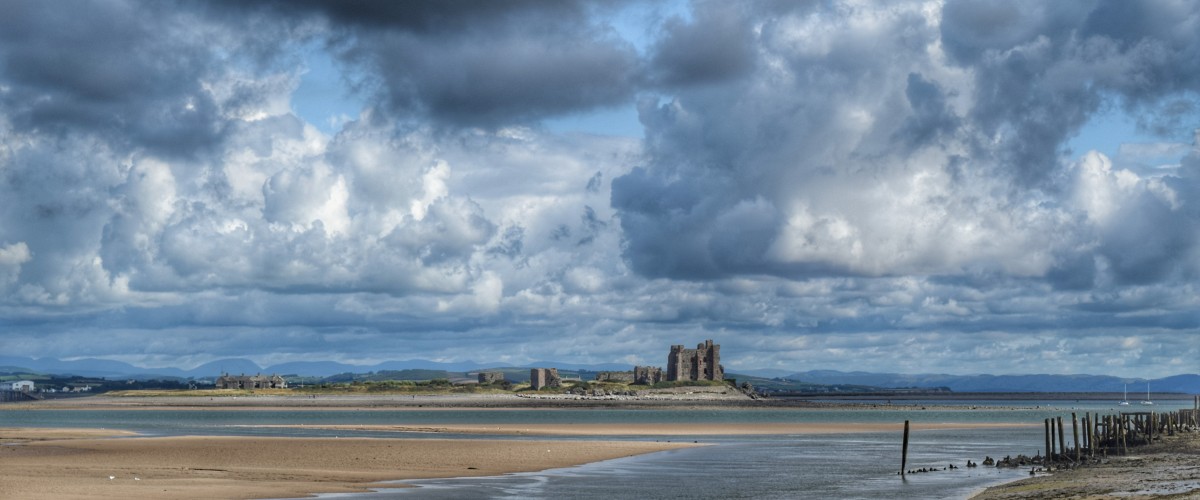
Walney Island is a low-lying, narrow island off the west coast of England, at the western end of Morecambe Bay in the Irish Sea. Some of Cumbria’s most spectacular coastline on the England Coast Path can be found on Walney Island. The circular coastal walk is full of glorious beaches, dunes and saltmarshes, wonderful wildlife and dramatic views of the Lakeland Fells in the north and the wide expanse of Morecombe bay in the south. South Walney is especially important to a wide number of migrating birds and is home to the Walney Bird Observatory – as well as a large colony of seals.
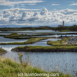
There are two walks around Walney Island. One follows the England Coast Path and the other offers extensions at the north and south tip, walking more on the sands at low tide. Both walks follow the island’s west coast, an 18 km strip of wide sandy beaches, dunes and impressive views across the Irish Sea, whilst the walk along the east coast faces the Walney Channel and vast stretches of precious salt marsh.
For the more adventurous there is a tidal walk to Walney Island from the mainland where it is possible to walk across the Walney Channel just north of the road bridge. At low tide, it is passable on foot, with stepping stones known locally as ‘Widow’s Crossing’.
- Look out for:
- Eider ducks, natterjack toads, Walney geranium
- Views of the Lake District fells
- vast, unspoiled beaches
- Route description:
The England Coast Path around Walney Island can be joined at any point, but for parking convenience Earnse Point on the west coast is a good place to start. The route heads north of the airport into the marshes and lagoons and then continues south along the east coast, through Vickerstown on streets and lanes before heading alongside the road south to Biggar (and its great pub). It continues along the road to South End Caravan site, then heads west to follow the west coast back to Earnse Point.
A fuller perimeter walk around the island is described in rhe downloadable route description on this page. It extends the walk to explore the wild sands at the north end of the island at low tide. It also describes the extension at the south end of the island, beyond the caravan site, to explore the South Walney Nature Reserve where there are great views of the other Furness Islands and a birdwatcher’s paradise.
- Getting there:
From Barrow-in-Furness follow signs for Walney Island. Cross Jubilee Bridge onto the island and turn right along The Promenade. Turn left along Mill Lane, following signs to Earnse Bay then turn right onto West Shore Road, just after the Island Tavern to the car park on the coast at Earnse Bay.
A number of buses travel between Barrow-in-Furnace to Vickerstown.
Join our Islandeering community
We continuously find new islands, rivers, lochs, canals and coast to walk, SUP and swim in and meet plenty of great folks along the way. Join our community to get new routes and adventures, latest blogs and news by using the email box below. Tune in also to our Facebook and Instagram pages to see where we are going next.


